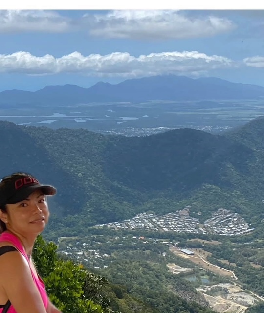
Originally written in 2020
I had been planning to climb Mt William for weeks, so yesterday I finally did it.
Mt William is 1,060 metres above sea level and is known for the 1986 plane crash that killed eight people.
Before the hike, I read reviews from other walkers describing the trail as difficult.
Naturally, I laughed.
I often think people exaggerate trail difficulty. Even Bartle Frere was enjoyable for me.
Well.
This time, the reviews were right. 
The problem wasn’t simply the climbing.
It was finding the track.
There were ribbons — mostly pink — tied to trees and shrubs to mark the way, but the actual trail was often barely visible.
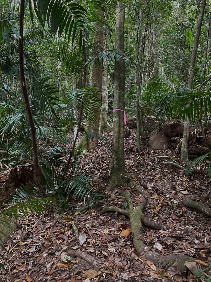
It’s probably because Mt William isn’t a heavily used track. Fallen leaves covered much of the ground, fallen trees interrupted the route, and vegetation had grown over sections that were probably once easier to follow.
Some ribbons may also have fallen or disintegrated over time.
So basically, the navigation technique became:
Find a ribbon.
Walk towards it.
Find another ribbon.
And if there isn’t one…
take your chances through the overgrown vegetation and hope another pink ribbon eventually appears.
There were also plenty of thick spider webs to walk through, which added another little pleasure to the experience.
After about four hours, I reached the plane crash memorial.
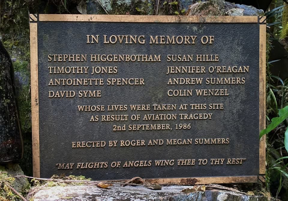
From what I understood, the actual crash site was about 250 metres below, while some of the aircraft wreckage had been moved closer to the peak as part of the memorial.
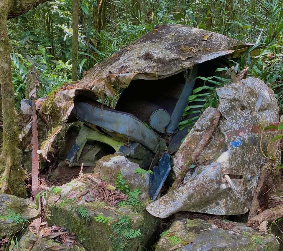
There was something sombre about being there.
Perhaps because Mt William’s story is so closely connected with that tragedy, but the mountain seemed to have a sadness about it.
It felt different from my usual hikes.
I eventually retraced my steps towards Smith Track.
My original plan was to take the shorter loop connecting Smith Track to Douglas Track and come down towards Stoney Creek at Kamerunga.
There was one particular reason.
I wanted to see Stoney Creek Falls.
I reached the falls at around 3 pm.
And then I had one of my brilliant ideas.
I thought:
Why don’t I just follow the creek downhill? That should be a shortcut.
It was not.
I climbed down the rocky side of the falls, lost my footing and slammed my right knee into a rock.
I was fairly certain I hadn’t shattered my kneecap, but it hurt enough that even moving the leg became difficult.
Rock-hopping down a creek suddenly seemed significantly less clever.
So I climbed back up.
Now I had two choices.
I could continue with my original loop on a track I didn’t know well.
But it was already around 4 pm.
Or I could return the way I came, which I estimated would take approximately one hour and ten minutes back to the car park.
I chose the familiar route.
Another excellent decision.
Or so I thought.
The first forty minutes weren’t too bad.
I used my tripod as a walking stick, which helped me move a little faster.
Then the tripod collapsed.
Apparently it had not been designed to function as emergency hiking equipment.
So I replaced it with a tree branch.
The final thirty minutes were a completely different story.
The descent was extremely steep, and with my right knee injured, I had been putting most of my weight through my left leg.
Eventually the left knee decided it had also had enough.
Now I had two bad knees.
Coming downhill over steep ground, exposed roots and rocks became agonising.
At times I couldn’t walk normally at all.
I ended up sitting on my bottom and slowly sliding myself downhill.
And because apparently the day needed another complication, my phone battery dropped to 2%.
I was trying to save it for an emergency.
Unfortunately, my increasingly frantic husband kept ringing me.
Graeme was waiting at the car park, it was getting dark, and by about 5:50 pm he was understandably becoming hysterical.
He asked how far away I was.
I told him:
“Normally? Five minutes.”
Unfortunately, my knees were no longer operating under normal conditions.
Graeme announced that he would come up and get me.
That frightened me more than being stuck there.
I immediately told him:
No. Find somebody who looks fit enough to run up the hill and help me down.
Graeme did actually attempt his rescue mission.
Then he saw the steep climb, exposed roots and rocks and sensibly decided that perhaps having two casualties was not going to improve the situation. 
Somehow, I eventually made it down.
Before it became completely dark.
So my carefully planned Mt William adventure included:
a confusing overgrown trail,
four hours of searching for pink ribbons,
a sombre plane-crash memorial,
Stoney Creek Falls,
one very stupid shortcut idea,
an injured right knee,
an overworked left knee,
a broken tripod,
a tree branch,
2% phone battery,
a frantic husband,
and a final descent mostly performed on my backside.
Just another relaxing day in the bush.
And yes.
This time, I believe the reviews.

